


emgleski sadržaji 2
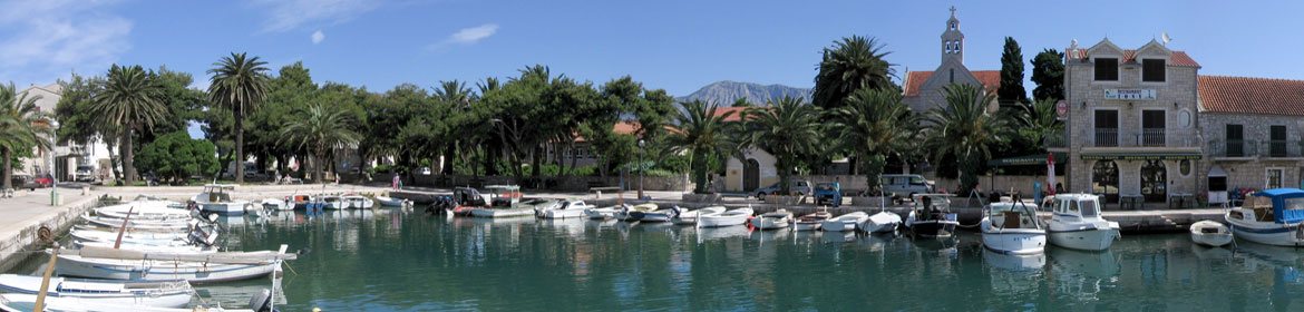
Jelsa is a small town situated in a bay on the northern coast of the central part of the island of Hvar. It borders with the two highest peaks on the island: St. Nicolas on the west and Hum on the east. Jelsa consists of two main parts: Vela Banda on the southern coast and Mala Banda on the northern.


Jelsa is an important tourist centre which has a rich tradition in tourism (the oldest hotel Jadran was built in 1911). The town is also well-known for its quality red wine for a long time ago. Major attractions include cultural and entertainment programs, various accommodation facilities (hotels, apartments, campsites, private rooms...), sports and recreational opportunities (football, basketball, volleyball, tennis, miniature golf, boccia, water sports, diving school...), gastronomic offer (fresh sea-food and famous wines) and excursions (to Bol on the island of Brac, to Makarska and to other places on the island of Hvar). Guests can rent motorboats, speedboats, bicycles, motorcycles or cars.


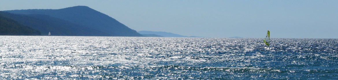
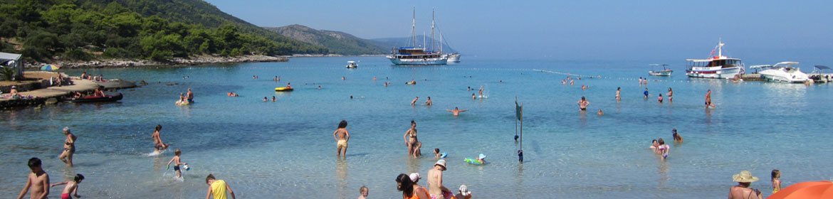
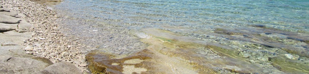
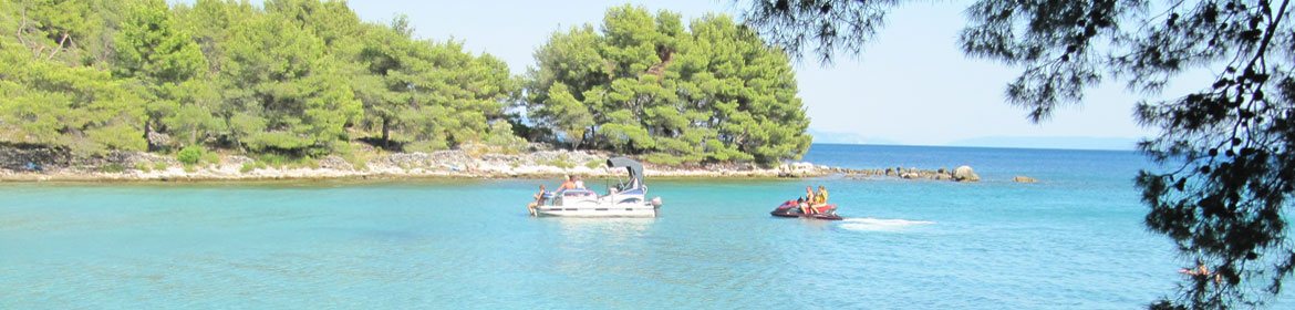
Jelsa has a coast line with numerous bays on which guests can find peace and pleasure. Tourists are attracted to the sandy, gravel and rocky beaches.
The most popular beaches in Jelsa are:
Mina beach - a sandy beach with a restaurant, about 500 m far away from the centre, ideal for children.
Grebišće - a sandy beach with a restaurant and a beach club, about 1.5 km far away from Jelsa.
Zenčišća - a beach situated 3 km east from Jelsa.
Bočić - a swimming place situated 300 m far away from the centre of Jelsa.
Bay of St. Luke (or Crkvica) - a pebble beach 4 km east from Jelsa (also an archeological site).


On the hill above Jelsa there is Tor, a massive fortification built of huge regular shaped blocks of stone joined without mortar. It was a Greek observation point, which stands on an older Illyrian fort. This fort is from the ancient period and it was of great importance in the Middle Ages. Jelsa was being developed since the 14th century as the port of Pitve, the village 3 km far away from the sea. Jelsa developed especially in the 19th century, due to shipbuilding and navigation. This conditioned its urban expansion and its acquisition of the main role on the central part of the island.


Jelsa has numerous cultural and historical monuments. The most famous are:
Church of St. Mary’s Assumption (from 1331), today the parish church.
Our Lady of Health Church built in 1535 at the top of Racic hill. The hill itself offers a beautiful view of valley and the port.
The Church of St. Rock built in the second part of the 16th century.
The Church of St. Michael built in 1463.
Lapidary (a collection of stone monuments) contains about twenty stone monuments dating back from ancient and mediaeval times.
Perivoj (public garden) - one of the largest and most beautiful parks in Dalmatia, created in 1870 on alluvial terrain. The large poplars, pine and palm trees, acacias and oleanders, bay laurel and other Mediterranean plants add to the beauty of the park.
Pjaca (main square) is situated in the centre of Jelsa. On the west side of the square there is a natural water spring, also known as the small river Slatina, which has been used by the local inhabitants since the ancient times.
Square of St. John is one of the most beautiful squares from the Renaissance-Baroque era, with a small octagonal St. John church from the end of the 15th century.
Small church of St. Luke is in the cove 4 km from Jelsa. In this area there are remains from the Roman period.


Stari Grad (ancient Pharos) is a town and a harbour at the end of the four nautical mile long bay on the northern side of the island of Hvar. The town is surrounded with vineyards, olive-groves and pine tree forest. Chief occupations include farming, viniculture, olive growing, fruit growing, grapes processing, fishing and tourism.


Stari Grad is a modern tourist centre. A variety of accommodation facilities (hotels, apartments, rooms, camps and bungalows), domestic specialities offered in the restaurants and wine cellars (especially seafood and famous Croatian wines) and sports and recreational opportunities (tennis, basketball, football and boccia including water sports surfing and diving) attract many visitors.


The summer months offer numerous cultural and sports events: The Summer of Stari Grad, concerts, recitals and shows. Stari Grad hosts the International Summer Music School in July and August. The first Sunday in September attracts many swimmers on the Faros Marathon, international Croatia cup in long-distance swimming.


The surrounding sea is well-known for its rich fish world, and the beaches are rocky, concrete and pebble. Smaller beaches are located in the coves inside the bay, and the underwater fishing is possible along the northern coast of the bay.


The most famous beaches in Stari Grad are:
Lanterna - a city beach 800 m far away from the centre of the town.
Maslina - a sandy cove which is situated nearby a ferry port.
Banj - a city beach which is made up of a gravel part and concrete boards.
Plaža Arkada - a swimming resort which is situated beneath a hotel complex in Stari Grad.
Paklena, Baba, Zavala and Žukova - gravel and rocky beaches which are situated on a peninsula Kabal that closes a deep bay of Stari Grad.


Stari Grad (eng. Old Town) is the oldest place on the island, founded by the Ancient Greeks in 385/384 BC as an independent polis of Pharos. At the time of the Roman colonisation it was called Pharis. From the formation of the Hvar commune in 1278, when Hvar became the island's main town, Stari Grad stagnated. The Greek town remained buried under the present day Stari Grad and only some fragmental architectural remains indicate its original lay-out, such as some parts of the 11 metre long Greek walls. These walls are a part of the north city wall, while the east walls are just visible behind the church of St . John. The stone blocks from the city walls were incorporated into the foundations of the bell tower indicates that this was the place where the main entrance of the town was.


Stari Grad is the city of cultural monuments. The most famous are: the church of St. John (raised on the antique foundations of the twin Basilica from the early Christian church - 5th/6th century), the church of St. Jerome (medieval chapel), the church of St. Nicolas (built in the 14th century), remains of the church of St. Lucia (from the 15th century - in 1571 destroyed by Turks), the church of St. Roch (built by Petar Hektorovic in the 16th century), the church of St. Peter and the Dominican Monastery (in this monastery there is museum with the oldest stone-inscriptions on Croatian ground, many archaeological findings from Pharos as well as other precious things), the parish church of St. Stephen (built in 1605 at the place where was first Hvar cathedral) and Tvrdalj (fortified castle of a poet Petar Hektorovic).

The town of Hvar, with its 3 519 inhabitants (2021), is the largest settlement on the island of Hvar. It is situated on the south-western coast of the island, in the cove protected by Pakleni Islands (Pakleni otoci in Croatian) in the south and a low crest in the north. The name of the town of Hvar derives from the Greek name Pharos, the ancient name for the whole island and the town of Stari Grad (Hvar became an island’s centre in 13th century).


The town's harbour provided a suitable location for a port, being geographically ideal and also protected by Pakleni Islands, making it a safe haven for boats hiding from hazardous winds. Pakleni Islands is a small archipelago where, on the biggest island of Sveti Klement, Palmižana Marina is located. There are also many beautiful beaches on the archipelago. Regular connections between Pakleni islands and Hvar are provided by taxi boats.


The town of Hvar is the centre of the island’s tourism, one of the favorite destinations in Croatia and one of the most prominent and visited tourist centers in the whole Adriatic Sea. The main attractions are: pleasant climate, a lot of sunshine, natural beauties, various accommodation facilities, gastronomic offer, sports and recreational opportunities, active nightlife.... Restaurants and taverns offer excellent fish specialities, with exquisite local wines.


The guests have a variety of quality accommodations at their disposal in hotels, apartments, guest houses, boarding houses and campsites. Sports and recreational opportunities are excellent - beach yoga, safari tours, tennis, climbing, hiking, basketball, football, water sports and many more.


You can find crystal clear sea with rocky and small gravel beaches in Hvar, and the most beautiful ones are on the Pakleni islands. Among them, the most popular are:
Jerolim - a well-known and long-established naturist beach equipped with showers, restaurant and a store.
Ždrilca - a woody cove on the Pakleni islands with several pebble beaches, many hidden spots for relaxing and enjoying, with few restaurants.
Stipanska - naturist beach equipped with showers, restaurant and a small shop.
Palmižana - an extensive cove with a shallow beach. It is surrounded with dense pine woods, bushes of scented heather and rosemary, and different exotic plants.
Pokonji Dol - a gravel cove with pebble beach, not far away from town
Mekičevica - only 2.5 km east of the centre of town, it consists of two pebble beaches.


Hvar is the town of a unique cultural and historical heritage such us: the fortress, the Cathedral of St. Stephan, the Franciscan monastery, town loggia, the Hektorović Palace, the arsenal and the theatre. The town also has many galleries, museums and exhibitions.


Hvar gained glory and power during middle ages being an important port within the Venetian, naval empire. The Roman settlement was located near the port (3rd c. BC), and the late antique at the foot of the hill, where the construction of town ramparts started after 1278. The centre of the old part of the town was formed in the 15th century. On the northern slope above the square, within the town ramparts are partly preserved palaces of the Hvar aristocracy.


Today Hvar is an important tourist resort with a centuries-old tradition in tourism.
01.01.2018. – 13.05.2018. & 15.10.2018. – 31.12.2018.
| Line 632 |
Every day / Svaki dan | |
| No | Sućuraj - Drvenik | Drvenik - Sućuraj |
| 1 | 06:30* | 08:00* |
| 2 | 9:30 | 11:00 |
| 3 | 12:30 | 13:30 |
| 4 | 15:00 | 15:45 (30.04. - 28.10.) |
| 5 | 16:30 (30.04. - 28.10.) |
17:15 |
| 6 | 18:00 | 19:00 |
| 7 | 21:30** | 22:10** |
| * On Holidays & Sundays – departure from Sućuraj at 07:30 and from Drvenik at 08:15 On 01/01, 25/12, 26/12 - departure from Sućuraj 07:30 and from Drvenik at 08:15 will not be held. ** On 24, 25 and 31/12 deparutre from Sućuraj 21:30 and from Drvenik 22:10 will not be held. * Nedjeljom i blagdanom trajekt iz Sućurja isplovljava u 07:30 sati, a iz Drvenika u 08:15 sati. Putovanje s polaskom u 07:30 sati iz Sućurja i 08:15 sati iz Drvenika ne održava se 01.01., 25.12. i 26.12. ** Putovanje s polaskom u 21:30 sati iz Sućurja i 22:10 sati iz Drvenika ne održava se 24.12., 25.12. i 31.12. |
||
On this page you can find ferry timetable - ferries for the island of Hvar: Sućuraj Drvenik (summer), Sućuraj - Drvenik (winter), Stari Grad - Split (summer) and Stari Grad - Split (winter).
To find more information about ferryboats (other lines, prices...), please visit Jadrolinija official web site.


01. 06. 2018. – 30. 09. 2018.
| Line 635 | Every day / Svaki dan | |
| No | Stari Grad - Split | Split - Stari Grad |
| 1 | 05:30 | 01:30 (30.06. - 03.09.) |
| 2 | 07:45 | 05:00 Cargo vehicles have boarding priority. |
| 3 | 11:30 On Saturdays personal vehicles have boarding priority. |
08:30 On Saturdays personal vehicles have boarding priority. |
| 4 | 14:00 | 11:00 |
| 5 | 17:30 | 14:30 |
| 6 | 20:00 (15.06 - 15.09.) |
17:00 (15.06 - 15.09.) |
| 7 | 23:00 (30.06. - 03.09.) |
20:30 |
On this page you can find ferry timetable - ferries for the island of Hvar: Sućuraj Drvenik (summer), Sućuraj - Drvenik (winter), Stari Grad - Split (summer) and Stari Grad - Split (winter).
To find more information about ferryboats (other lines, prices...), please visit Jadrolinija official web site.
01.01.2018. - 31.05.2018. & 01.10.2018. – 31.12.2018.
| Line 635 | Every day / Svaki dan | |
| No | Stari Grad - Split | Split - Stari Grad |
| 1. | 05:30* | 06:00 (16.04.-31.05. & 01.10. - 26.10) Does not sail on Saturdays, Sundays & Holidays |
| 2. | 11:30 | 08:30* |
| 3. | 14:30 (16.04.-31.05. & 02.10. - 30.10) Does not sail on Saturdays, Sundays & Holidays |
14:30 |
| 4. | 17:30 | 20:30 |
|
*On 25/12 & 26/12 – does not sail from Stari Grad at 05:30 h & from Split at 08:30 h |
||
On this page you can find ferry timetable - ferries for the island of Hvar: Sućuraj Drvenik (summer), Sućuraj - Drvenik (winter), Stari Grad - Split (summer) and Stari Grad - Split (winter).
To find more information about ferryboats (other lines, prices...), please visit Jadrolinija official web site.
14.05.2018. - 14.10.2018.
| Line 632 |
Every day / Svaki dan | |
| No | Sućuraj - Drvenik | Drvenik - Sućuraj |
| 1 | 05:00 (29.06. - 02.09.) |
05:45 (29.06. - 02.09.) |
| 2 | 6:30 | 7:30 |
| 3 | 8:15 (01.06 - 30.09.) 8:30 (14.05. - 31.05.) (01.10. - 14.10.) |
9:00 (01.06 - 30.09.) 09:30 (14.05. - 31.05.) (01.10. - 14.10.) |
| 4 | 9:45 (01.06 - 30.09.) 10:30 (14.05. - 31.05.) (01.10. - 14.10.) |
10:30 (01.06 - 30.09.) 11:30 (14.05. - 31.05.) (01.10. - 14.10.) |
| 5 | 11:15 (01.06 - 30.09.) |
12:00 (01.06 - 30.09.) |
| 6 | 13:00 (01.06 - 30.09.) 12:30 (14.05. - 31.05.) (01.10. - 14.10.) |
13:45 (01.06 - 30.09.) 13:30 (14.05. - 31.05.) (01.10. - 14.10.) |
| 7 | 15:00 | 15:45 |
| 8 | 16:30 | 17:15 |
| 9 | 18:00 | 19:00 |
| 10 | 19:45 (15.06. - 16.09.) |
20:30 (15.06. - 16.09.) |
| 11 | 21.30 (14.05. - 14.06.) (17.09. - 30.09.) 22:00 (15.06. - 16.09.) |
22.10 (14.05. - 14.06.) (17.09. - 30.09.) 22:35 (15.06. - 16.09.) |
On this page you can find ferry timetable - ferries for the island of Hvar: Sućuraj Drvenik (summer), Sućuraj - Drvenik (winter), Stari Grad - Split (summer) and Stari Grad - Split (winter).
To find more information about ferryboats (other lines, prices...), please visit Jadrolinija official web site.
![]() 03 July 2014
03 July 2014
For the last few months we have been working on the project of "new Sućuraj homepage", in the aiming to modernise our work and present out Sućuraj with more quality. The project consists of changing the website structure, most of the text and the technology use in making the site. Many new photographs were added which fallow the text on most of the pages.
The work on the project isn't completely over. Some parts of the site still function on the old platform (accommodation), some are unfinished and there are probably some mistakes, so we ask our visitors to acknowledge that. If anyone should notice any mistakes, or has an objection we ask them to write to us on our e-mail or our Facebook page. We hope that you will all be happy with this project.
Remark: this site is made by Yoomle 3.3.0 so the site viewed from old versions of Internet Explorer (8 and older) which do not support css3 and html5 will look messed up. According to our statistics in the last month about 7% of our visitors still use the mentioned old versions of IE so we ask you, if you are in this group, to install newer versions of IE or some other browser. The site if flexible and adapts to devices of different resolution, so it should look neat even if viewed on tablets or smart phones, what wasn't the case before.
Authors of Sućuraj homepage salute you
 ♦ Tam-Tam Music Festival
03 July 2014
On 1st and 2nd of August 2014 the third annual Tam Tam Music Festival will be held in Sućuraj. The festival is a music manifestation organized by civil association Pelišnjak and has the goal of making Sućuraj a real, if small, festival destination. As the previous two years, the main program will be held in the local football field. The novelty to the prior editions is the change in the format of the festival, so visitors can enjoy 2 days of quality rock music. The camping isn't organised but the possibility of camping on the field and around it does exist.
Performers: Laka / Repetitor / Punčke / M.O.R.T. / Vlasta Popić / Stuttgart Online / Artan Lili/ Seven Mouldy Figs / Spiridon / Les Agamemnonz
www.sucuraj.com
www.sućuraj.com
 Hrvatski: Otok Hvar, Hrvatska - Sućuraj homepage
Početna
Informacije: • O Sućurju • Novosti • Znamenitosti • Povijest (Iliri i Rimljani, Srednji vijek, Borbe s Turcima, 19. stoljeće, 20. stoljeće) • Klima, flora i fauna • Zabava i kultura • Sport i rekreacija • Izleti • Ribarstvo • Poljoprivreda • Gastronomija
Plaže i uvale: • Plaža Česminica • Plaža Bilina • Plaža Mlaska • Uvala Perna • Put punte • Punta Mačka i "ispod ceste • Valica i Blace • Uvala Prapatna • Uvala Židigova • Uvala Mrtnovik • Uvala Brigove • Uvala Didina • Sjeverna obala (ostalo) • Južna obala (ostalo)
Smještaj: • Apartmani • Sobe • Kuće i vile
Promet: • Kako doći • Plovidbeni red trajekta • Karte
Otok Hvar
Galerija: • Panorama (Porat, Iz zraka, S mora, S brda, Lanterna, Kale, Oko Sućurja) • Plaže • Ostalo (Stari Sućuraj, Brodovi, Crkve, kapelice..., Izlasci i zalasci sunca, Priroda, Agave, Razno)
Novosti
Linkovi
O nama
NK Mladost
Udruga Pelišnjak
 English: Island of Hvar, Croatia - Sucuraj homepage
Home
Information:• About Sućuraj • News • Sights • History (Illyrians and Romans, Middle Ages, Fighting the Ottomans, 19th century, 20th century)
Climate,flora and fauna • Entertainment and culture • Sport and recreation • Excursions • Fishing • Agriculture • Gastronomy
Beaches and bays: • Česminica beach • Bilina beach • Mlaska beach • Perna bay • Towards the Cape • Mačak cape and "under the road" • Valica and Blace • Prapatna bay • Židigova bay • Mrtnovik bay • Brigove Bay • Didina bay • North side (the rest) • South side (the rest)
Accommodation: • Apartments • Rooms • Houses and villas
Travel info: • How to reach us? • Ferry timetable • Maps
Island of Hvar
Gallery: • Panorama (Port, From the air, From the sea, A view from the hill, Lighthouse, Narrow streets, Around Sućuraj) • Beaches • Other (Old Sućuraj, Boats, Churches, chapels..., Sunrise-sunset, Nature, Agaves, Uncategorized)
News
Links
About us
FC Mladost
Association Pelišnjak
 Deutsch: Insel Hvar, Kroatien - Sucuraj homepage
Startseite
Informtionen: • Über Sućuraj • Sehenswürdigkeiten • Geschichte • Klima, Flora und Fauna • Unterhaltung und Kultur • Sport und Erholung • Ausflüge • Fischfang • Landwirtschaft • Gastronomie
Strände und Buchten: • Česminica Stränd • Bilina Stränd • Mlaska Stränd • Perna Bucht • Auf dem Weg zum Kap • Mačak Umhang und... • Valica und Blace • Prapatna Bucht • Židigova Bucht • Mrtnovik Bucht • Brigove Bucht • Didina Bucht • Nordseite (der Rest) • Südseite (der Rest)
Unterkunft: • Ferienwohnungen • Ferienhäuser und Villen • Zimmer
Reise-Info: • Wie kann man zu uns kommen? • Fahrplan der Fähre • Maps
Insel Hvar
Galerie: • Panorama (Hafen - Mitte, Aus der Luft, Aus dem Meer, Der Blick vom Hügel, Leuchtturm, Schmale Gassen, Rund Sućuraj)• Stränd • Sonstiges (Alte Sućuraj, Boote, Kirchen und Kapellen, Sonnenaufgang, Natur, Agaven, Uncategorized)
 Italiano: Isola di Hvar, Croazia - Sucuraj homepage
Home
Informazioni: • Informazioni sul paese • Monumenti • Storia • Clima, flora e fauna • Svago e cultura • Sport e ricreazione • Gite • Pesca • Agricoltura • Gastronomia
Spiagge e insenature: • Spiaggia Česminica • Spiaggia Bilina • Spiaggia Mlaska • Baia Perna • Verso Capo• Mačak mantellina e "sotto la strada" • Valica e Blace • Baia Prapatna • Baia Židigova • Baia Mrtnovik • Baia Brigove • Baia Didina • North Coast (altro) • South Coast (altro)
Accomodazionne:• Appartamenti • Case e ville • Camere
Trasporti:• Come arrivare? • Orario traghetti • Mappe
Isola di Hvar
Galleria:• Panorama • Spiagge • Altro
 Polski: Wyspa Hvar, Chorwacja - Sućuraj homepage
Start
Sućuraj info
Wyspa Hvar info
Plaże i zatoki;Plaża Česminica, Plaża Bilina, Plaża zatoczka Mlaska, Plaża zatoczka Perna, Put punte, Punta Mačka i "ispod ceste", Valica i Blace, Zatoczka Prapatna, Zatoczka Židigova, Zatoczka Mrtnovik, Zatoczka Brigove, Plaża zatoczka Didina, Północnej stronie (reszta), Południowej stronie (reszta)
Kwatery: apartamenty, pokoje, vily, domy, pensjonaty
Jak dojechać?
Fotogaleria
 Čeština: Ostrov Hvar, Chorvatsko - Sučuraj homepage
Začátečná
Sućuraj info
Ostrov Hvar info
Pláže a zátoky: Pláž Česminica, Pláž Bilina, Pláž zátoka Mlaska, Pláž zátoka Perna, Put punte, Punta Mačka a "ispod ceste", Valica a Blace, Zátoka Prapatna, Zátoka Židigova, Zátoka Mrtnovik, Zátoka Brigove, Pláž zátoka Didina, Severní strana (jiný), Jižní strana (jiný)
Ubytování: apartmány, domy, pokoje, vily, penziony
Jak přijet?
Fotogalerie
 Slovenčina: Ostrov Hvar, Chorvátsko - Sučuraj homepage
Hlavná stránka
Sućuraj info
Ostrov Hvar info
Pláže a zátoky: Pláž Česminica, Pláž Bilina, Pláž zátoka Mlaska, Pláž zátoka Perna, Put punte, Punta Mačka a "ispod ceste", Valica a Blace, Zátoka Prapatna, Zátoka Židigova, Zátoka Mrtnovik, Zátoka Brigove, Pláž zátoka Didina, Severná strana (iný), Južná strana (iný)
Ubytovanie: apartmány, penzióny, domy, izby, vily
Ako sa dostať?
Galéria
 Slovenščina: Otok Hvar, Hrvaška - Sučuraj homepage
Domov
Sućuraj info
Otok Hvar info
Plaže in zalivi:Plaža Česminica, Plaža Bilina, Plaža zaliv Mlaska, Plaža zaliv Perna, Put punte, Punta Mačka in "ispod ceste", Valica in Blace, Zaliv Prapatna, Zaliv Židigova, Zaliv Mrtnovik, Zaliv Brigove, Plaža zaliv Didina, Severna stran (ostalo), Južna stran (ostalo)
Namestitev: apartmaji, penzioni, vile, hiše, sobe
Kako priti do nas?
Fotogalerija
") Athens’s triera Athens’s triera(Greek’s war ship) |
") "Liburska liburna" "Liburska liburna"(Illyrians war ship) |
 Part of queen Teuta place Part of queen Teuta placein Sucuraj |
 Amphorae from sunken roman Amphorae from sunken romangalleys - founded near Sućuraj |
 Anchor from sunken roman Anchor from sunken romangalleys - founded near Sućuraj |
") Illyrian grave ("zgrčavac") Illyrian grave ("zgrčavac")near Sućuraj |
 Graves in the shape of small Graves in the shape of small houses - a remnant of old roman customs |
 In Oglavak and Koscak (near Sucuraj) by the tradition was the position of the Illyrian queen Teuta place (who lived here). Sucuraj lies on the foundations of the town she was building. It was not finished it because she lost the war with the Romans.
To confirm these legends there are no written documents because the Illyrians were illiterate. The historical facts are: in the middle 4th century BC the Illyrians tribe Ardians came to the sea and settled around the river Neretva and toady's Makarska Riviera; the Ardians where famous warriors, and after arriving to the coast they learnt the seaman ways and became pirates who first attacked Greeks and after Romans ships; for pirate-activity Sucuraj was ideal, because of it's deep bay where war-ships are invisible and the hill above Sucuraj was a excellent look-out for all ship traffic in this region; from Sucuraj they could quickly attack and conquer ships in the area. Besides the bay was a big fertile field, and it is known that Ardians had 300 000 serfs who worked in there fields while they were at war or having fiestas with lots of beer, wine and drink sweetened with honey.
In the middle 3rd century BC the Ardians king Argon united several Illyrians tribes and extended his country from Biograd (near town Zadar) to the river Drim (in today's Albania). King Argon died in 231 BC of enjoying too much alcohol. The authority over he kingdom inherited his wife Teuta because their son Pinnes was under-age. Teuta ruled until 219 BC, she was glorified by heir warlord Demetrius of Pharos (today town Stari Grad on the island Hvar). Teuta was in war with the Romans because of the pirate attacks. After the first successes she lost the war when Demetrius turned sides to the Romans. Teuta took refuge to the fortress Risan in Boka Kotorska (today in Montenegro). The big Illyrians country was reduced to the territory between Boka Kotorska and the river Drim.
So, if the legend of Queen Teuta it true, Sucuraj is one of the oldest towns in Europe. Contribution to this legend is many sunken Roman galleys around Sucuraj.
Soon after Demetrius of Pharos went into battle with the Romans who destroyed Pharos in 219 BC. By the legend the Illyrians soldiers fled over the island to the east and come to Sucuraj. With no were to go they occupied Teuta's fortress. Illyrians objects confirm that they fortify the harbour of Sucuraj and protected the village, which means that the Illyrians lived in Sucuraj after 219 BC.
The remains of the queen Teuta palace and the fortress of Demetrius of Pharos are still visible. Also, many Illyrians graves with bones, ceramic and seashells are found. There are many Illyrians stone-piles; the most famous is ''Velika Gomila'' (old Illyrians grave-yard). Around Sucuraj there are many more localities from the Illyrians time that testifying the presence of Illyrians before 2300 years.
The Romans conquerd island Hvar after the battle with the Illyrians 219 before Christ. In Sucuraj there are ruins of two Roman towns, proclaimed to the world 1525 by eridute Dominican Vinko Probojevic in his famous speech ''About origin and occasions of the Slavens''.
These towns were ruined in the Turk wars. The first Roman town in Sucuraj was located in today's Gornja Banda; the second was near Mlaska bay. The middle of the first town must have been in place of today's monastery, because of a white mosaic found there; most of it is preserved in the parish treasury. It came from a rich Romans place. At the location of the second town many remains can be seen, Roman walls, manors and country-houses a very well preserved well ("gustrina") and many other remains. In many locations in the sea around Sucuraj, remains of many Roman galleys and lots of Amfor's (jars for wine, oil, honey, etc.).
History of Sućuraj:
1. Antique Sućuraj (Illyrians and Romans)
2. Sućuraj in the Middle Ages (arrival of Croatians)
3. Sućuraj during Venetians (fighting the Ottomans)
4. Sućuraj in the 19th century (Austria, France and the Austria-Hungary kingdom)
5. Sućuraj in the 20th century (3 wars, 6 states)
 Old church of st. George Old church of st. George |
 Old parish church and monastery Old parish church and monastery(13rd century) |
") The Franciscan monastery The Franciscan monastery(9th century) |
") In the 7th and 8th century came the Croats and colonized Neretva valley, coast, peninsula Peljesac of course island of Hvar. In this colonization Sucuraj was an eminent location, because of its position. It's hard to imagine colonization of the middle dalmation islands without occupying the east cape of the island Hvar – Sucuraj.
In the 7th and 8th century came the Croats and colonized Neretva valley, coast, peninsula Peljesac of course island of Hvar. In this colonization Sucuraj was an eminent location, because of its position. It's hard to imagine colonization of the middle dalmation islands without occupying the east cape of the island Hvar – Sucuraj.
Sucuraj harbour was a first a very convenient location for the pirates from Neretva. There are archaeological findings that the population for security from pirate attacks made a town further away from the harbour in the fields surrounding Sucuraj.
The Neretva-pirates were baptized after the year 870. In the court yard of the church of St. George are remains of the base of a 9th century chapel. On these bases in the 13th century Augustine fathers built a church dedicated to St. George, it is mentioned in the Hvar statute from 1331. The church was destroyed in the 19th century, after witch a new church was built. Sucuraj got its name form that church (Sucuraj = St. Georges city). The Augustine's made the monastery in Sucuraj; it has been ruined and restored many times. This monastery still exists today. On the doorway there is an in scription: COENOBIVM ORDINIC FRATRVM EREMI. TARVM S. AVGVSTINI. MCCCIX RASTAVRATVM (Monastery of the hermit brothers of St. Augustine, restored 1309). The monastery vas restored in 1309 because it was burnt-dovn in 1280 by Omis pirates.
Mediaeval Sucuraj was consisted of more than one settlement. The first was near Mlaska bay, devasted by the Turks in 1526. Most of mediaeval population of Sucuraj lived in old Sucuraj near the fields, the remains can still be seen. The third settlement was in nowadays Gornja Banda.
History of Sućuraj:
1. Antique Sućuraj (Illyrians and Romans)
2. Sućuraj in the Middle Ages (arrival of Croatians)
3. Sućuraj during Venetians (fighting the Ottomans)
4. Sućuraj in the 19th century (Austria, France and the Austria-Hungary kingdom)
5. Sućuraj in the 20th century (3 wars, 6 states)
 Fort Fortica from 1613 Fort Fortica from 1613 |
 Drawing of the Sućuraj from 1613 Drawing of the Sućuraj from 1613 |
 Drawing of the Sucuraj harbour and fortress from 1635 Drawing of the Sucuraj harbour and fortress from 1635 |
 Monumental plate from 1655 Monumental plate from 1655 |
 Church of St. Anthony from 1663 Church of St. Anthony from 1663 |
 Remains of the Bishops palace from the 17th centur Remains of the Bishops palace from the 17th centur |
 Drawing of the Bishops palace Drawing of the Bishops palace |
 The Venetians dominated the island Hvar from 1420 to 1797. The second half of the 15th century is the most difficult part of the history of Sucuraj. After the full of Bosnia, Turks occupied from 1464 to 1482 the Neretva valley, Makarska coast and came to the doors of Sucuraj. Sucuraj became the eastern end of the Venice republic. On the coast where the Turks, peninsula Peljesac were under the Republic of Dubrovnik, so Sucuraj was between three countries.
Sucuraj was under blows from the Turks armed-ships from Neretva and the coast, while the other places on island Hvar where not attacked. In these hard times, Sucuraj was robbed and burnt three times. The first time was in 1526, evidence of that is in the oldest saved document in the monastery archive dated 26.04.1526. The citizens were killed, taken as slaves, while some escaped. From a developed port-town, Sucuraj became devastated. Everything started from nothing.
The renovation of the village started, some of the citizens came back, and new inhabitants arrived fledging from Turk attacks on the coast. The second time the Turks robbed and burnt Sucuraj in 1539, after the people from Sucuraj with Omis pirates and Senj ''uskoks'' started active piratical actions. Pirate actions became a constant way of opposing the Turks and the Dubrovnik Republic.
After 1539 the reconstruction of Sucuraj starts again, and admission of new settlers feeding from Turks. In April 1570 1000 "uskok" and "hajduk" fighters gathered in Sucuraj and with 50 various vessels and 1 Venice galiq left to attack the Turks in Neretva valley but they did not succesed. After this came the deadfull 1571 when the Turks attacked Korcula, Stari Grad, Vrbovska and Jelsa. On the day 07.10.1571. Took place the big sea-battle of Lepant in which the Christian flote defeated the Turks, this became a turning-point in the war and the end of Turk prevail on the Mediterranean Sea. Several fighters from Sucuraj took part in this battle.
At the same time Turks from Neretva attacked undefended Sucuraj, burnt down for the third time the monastery and village, killed or took as slaves the citizens who did not escape. After these three devastations and killings the old inhabitants of Sucuraj vanished. Sucuraj is in ruins, all the houses in Gornja Banda and the new ones in Donja Banda (peninsula Gubavac) whose colonization started in 16th century.
Sucuraj is rebuilding for the third time, new inhabitants are arriving from the coast, fleding from Turks. After this devastation the Venice administration ordered the building of a fortress (fortica) to protect the harbour and village. Fortica was built in 1613, and finish in 1635. It had 10 canons and a regular military crew (photo). Life in Sucuraj became safer. Donja Banda in now more occupied than before, and the houses in Gornja Banda are rebuilt.
The 17th century was gold age of Sucuraj history. In that time the village became an urban town with all necessary buildings and a big harbour. In this century Sucuraj had 4 churches and 3 monasteries. The population coming from areas under Turk occupation came with Francis priestess. As the coast was under Turks the bishop of Makarska fra Bartul Kacic Zarkovic took care of his flok from Sucuraj. He built a palace (Bishop's palace) ruined in the 2nd world war. Bishop fra Bartul died in 1645 and was buried in the old church St. Geroge. The death of the bishop the people of Sucuraj lost the popular spiritual and national leader, creator of modern Sucuraj. In the hall of the new St. George church is a monumental plate written in "bosanica" (old Croatian writing), which was put up in the honour of the bishop in 1655, by the duke Petar Kulusic – a Sucuraj-warrior, legendary leader of all pirate, hajduk and uskok units in Krajina and on Hvar.
The Francis priestess from Zaostrog built in 1663 the baroc church of St. Anthony, which still exists. In 28.04.1664. The Turks attacked Sucuraj and captured 12 men, but the people of Sucuraj made a counter-attack and liberated the captives and captured some Turk soldiers. After this the Turks never came to Sucuraj again and the economic evolution of Sucuraj began.
In the 18th century the glory and economic power of Venice falls so the market goes from the Mediterranean to the Atlantic and India, so it is an economic stagnation in Sucuraj.
History of Sućuraj:
1. Antique Sućuraj (Illyrians and Romans)
2. Sućuraj in the Middle Ages (arrival of Croatians)
3. Sućuraj during Venetians (fighting the Ottomans)
4. Sućuraj in the 19th century (Austria, France and the Austria-Hungary kingdom)
5. Sućuraj in the 20th century (3 wars, 6 states)
 from 1870") Harbour bank (pumpurela) Harbour bank (pumpurela)from 1870 |
 School and township from 1888 School and township from 1888 |
 New church of St. George New church of St. Georgefrom 1897 |
 Lighthouse from 1898 Lighthouse from 1898 |
 Ater the peace settlement in Camofori in May 1797, the Venice part of Dalmatia and Boka Kotorska became Austrian. After 377 years of Venice administration, Sucuraj had a new ruler. Austria went to war with Napoleon in 1798 so her sovereignty was short. On the 26.12.1805 Dalmatia and whit it Sucuraj came under France.
In March 1806 the fortress in Sucuraj was taken over by a French military crew. Soon after there was a battle between the French and Russian war-ships in front of Sucuraj. The Russians in Autumn the same year robbed a big French wine-magazine in Sucuraj, they took 6150 litters of wine and 24 litres of vinegar! On the day 26.04.1807 Russian ships and Montenegro pirates again attacked Sucuraj but heroic resistance of armed Sucuraj people turned them back. The French general provincial as gratitude ordered the sale of wheat from the magazines to the people of Sucuraj with a big discount – at 10 times less price.
After these times there was a short peaceful time and economical development of Sucuraj. By decision of Napoleon on 25.04.1811 Sucuraj became a district. At this time started the building of the new graveyard (now called the old); a road to Hvar and public lighting was instalated. The old lighthouse was built and sacred to St. Anthony the monarch. After the defeat of Napoleon near Moscow the French lost authority over Sucuraj and Sucuraj went back under Austrian authority.
In 1817 the elementary school in Sucuraj was established. In 1867 came the Austrian-Hungary agreement and the Austria-Hungary monarchy was established. In the middle 19th century started the big economic develop of Sucuraj. The main economic branches were fishing, vineyards and olive-oil making. In Sucuraj there were 11 big nets for catching sardines, the vineyards gave 1500 tons of vine, the most famous called Prč (or Muscat) and vas used in the place of the emperor Francis-Joseph. The post office was built in 1868, the telegraph in 1871. In this time many public objects were built. First in 1870 the pier was built ("pumpurela") and part of the harbour bank. In 1888 the district building and elementary school was built, in 1889 the first public well with drinking water. In 1897 the new church of St. George, in 1898 the new lighthouse.
At the end of the 19th century came filocsery – a disease that in a few years destroyed the biggest part of the Sucuraj vineyards, the main economic branch in Sucuraj.
History of Sućuraj:
1. Antique Sućuraj (Illyrians and Romans)
2. Sućuraj in the Middle Ages (arrival of Croatians)
3. Sućuraj during Venetians (fighting the Ottomans)
4. Sućuraj in the 19th century (Austria, France and the Austria-Hungary kingdom)
5. Sućuraj in the 20th century (3 wars, 6 states)
 Sućuraj 1913 Sućuraj 1913 |
 Sućuraj 1922 Sućuraj 1922 |
 Sućuraj 1950 Sućuraj 1950 |
 Sućuraj, the end of 60’s Sućuraj, the end of 60’s |
 Construction of a new ferry Construction of a new ferryport 1973/74 |
 Sucuraj, middle 70’s Sucuraj, middle 70’s |

Sucuraj, the end of 20th century |
 Emblem MOMP Zvir - Hvar, 1993 Emblem MOMP Zvir - Hvar, 1993 |
 The disease filocsery almost destroyed the strongest economic branch in Sucuraj – viniculture (the beginning of the 20th century) so emigration to overseas countries was vast. As if there was not enough trouble in 1914 the 1st world war started. Men from Sucuraj were mobilized and sent to various fronts, seven of them lost their lives.
The 1st world war finished in 1918 with the defeat of the Austria-Hungary empire, so Sucuraj comes under a new master – Italy. The people didn't accepted that willingly. By the Rapal agreement from 1920 it is decided that the Italians must leave most of Dalmatia, so Sucuraj comes under the Kingdom SHS (after Kingdom Yugoslavia) on the 21/04/1921. When Italians left Sucuraj there was a big celebrate (picture right). The new administration introduced new taxes, which increased the bad economic situation in Sucuraj. The vineyards were restoring (slowly), fishing was the main occupation. In 1938 a sardines factory was built, it is the first industrial object in Sucuraj.
However, peace didn't last long – the 2nd world war started. The Yugoslav Kingdom capitulated on the 17/04/1941. After the capitulation Sucuraj was officially included in the NDH ("Independent State of Croatia") but Sucuraj against the will of its population was occupied by an Italian garrison. Fishing was possible only with permission of the Italian administration, NDH documents were not legal. The men of Sucuraj didn't accept recruitment to the armed forces of NDH, so they hide in the woods, and after they went to the Partisan forces. On the 24/11/1942 the Italian forces briefly leave Sucuraj and it becomes a free partisan territory. In that time a fishing-boat called "Sloboda" (freedom) left Sucuraj harbour and became the 2nd Partisan war-ship on the Adriatic. On the 18/01/1943 the Italian soldiers return to Sucuraj in much bigger strength. Italy capitulated on the 08/09/1943 and the Italian garrison of 300 soldiers surrendered to the partisans of Sucuraj on the 12/09/1943.
The town is free for the 2nd time and becomes a free territory again. On the 21/09/1943 from Makarska comes NDH soldiers and after them the German forces. Sucuraj is in the middle of the war swirl. Around Sucuraj many sea, air and land battles were led. Sucuraj was almost totally destructed by air bombing (German and Allied). The population is evacuated to Slavonia and El Shat (in Egypt). The Germans left the town on the 21/09/1944. Partisans moved in to destroyed Sucuraj. At the beginning of 1945 the refugees from El Shat came back, and in summer the ones from Slavonia.
After the war the Yugoslav Federation was established with Croatia as a part of its. The total bilance of this war was catastrophic for Sucuraj: 40 people were killed, 18 died as refugees. Buildings were destroyed the 17th century bishop palace, the new district building and school, the Venice fortress was badly damaged. Sucuraj is one more in its history rebuilt from nothing. The life was varying hard after the war so the rebuilding is slow. You can sea trails of destroying on picture left from 1950. Fishing and agriculture are restored and in 1953 the sardine's factory starts to work again.
A bigger development starts in the 60-iec, in 1961 a road to Hvar is made, electricity came from the coast (from 1958 electricity was from the factory's power-plant). In 1963 started the ferryboat line Sucuraj – Drvenik (1st ferryboat has called "Tratica"), in 1969 a layer of asphalt was put on the road to Hvar. Very big changes start in Sucuraj at the end of the 60-ies and the beginning of the 70-ies – tourism starts: in 1970 the hotel called Perna was built, new houses are built, old ones are renovated and the town gets a new face. In 1974 the new ferryboat pier was built, in 1978 a car-camp was built in Mlaska bay. Drinking water from the mainland came in 1986, the living standard were much bigger.
When everything was going good, for the 3rd time in the 20th century it was stopped by another war. These time the Big-Serbia invasion of on Republic Croatia. At the referendum in May 1991 the people of Sucuraj voted (98%) for the independent state of Croatia, which after many centuries became an independent country. In August 1991 an army unit of ZNG was established in Sucuraj. Sucuraj in surrounded by Yugoslav navy ships, which in a few occasions put up a blockade of the town and forbid all traffic by sea. However the blockade didn't stop the organization of a fast-boat line to the coast – the only connection the island Hvar had with the rest of the world. On the 3/12/1991 the Yugoslav ships leave the Sucuraj aquatorid waters.
Learned from history the people started organizing the defence of the town, but thankfully in this war there were no big military battles near Sucuraj. Sucuraj organised the admission of a refugees from other parts of Croatia and Bosnia and Hercegovina. The army unit of ZNG was reorganized and most of the young men of Sucuraj became a part of a mixed unit of marines called Zvir – Hvar and in 1993 and '94 participate in military actions around Zadar (near Novigrad and on the mountain Velebit). From 1992 to 1994 the old Augustine monastery was completely renovated. So, the war finished, tourism starts again and it becomes the main economic branch in Sucuraj.
History of Sućuraj:
1. Antique Sućuraj (Illyrians and Romans)
2. Sućuraj in the Middle Ages (arrival of Croatians)
3. Sućuraj during Venetians (fighting the Ottomans)
4. Sućuraj in the 19th century (Austria, France and the Austria-Hungary kingdom)
5. Sućuraj in the 20th century (3 wars, 6 states)
Sućuraj, a small picturesque tourist and fishermen's town and port, is the most eastern settlement on the island of Hvar (central Dalmatia, Croatia), and is also nearest to the mainland. The Island of Hvar is one of a group of central Dalmatian islands and is the longest Croatian island, populated from early historic times. This island is attractive for tourists because of its clean beaches and bays, unspoiled nature, lots of sun, olive oil and wine and especially for its hospitable hosts.
Tourism development started in Sućuraj at the beginning of the 1960's. Hospitable people offer their guests accommodation in numerous beautiful private apartments, boarding houses (pensions), holiday houses and rooms.
Accommodation in Sućuraj, island of Hvar: private apartments, rooms, houses and villas to rent. We offer you a comprehensive list of rental accommodations for your pleasant vacation in Sućuraj on the east cape of the island of Hvar.

Sucuraj homepage - island of Hvar, Croatia


![]()

About us - Contact
Site-map
Copyright © www.sucuraj.com
Since 2001
 English
  Slovenčina
  Slovenščina